The Nature of Grief

Well, it’s been about 10 months since Amy died, and I still get pretty sad sometimes. This whole grief thing would be a lot easier if I knew when it was going to end – I could even live with God assigning a random time: “Sir (would God call me sir?), you will be sad for exactly 18 months” or “Ma’am, congratulations, you will only be despondent for seven months!”. But the never-expiring nature of grief makes it even harder to bear, wondering if I can actually keep resisting it forever.

People tell me it will get easier. One of my bed-and-breakfast hosts in New Zealand, an amazing 90-year-old widow whose husband died about five years ago, told me: “The waves of grief will lessen until they are more like a ripple on the beach”. What a nice thought! But that sure hasn’t happened yet.

I’ve also thought a lot about how it should’ve been me that died. For sure, I would’ve traded places with Amy if I could have, but that’s not what I mean. I just can’t help thinking that the whole WORLD would be happier. First off, Amy had a lot more friends than I do, so there are a lot more people saddened by her loss. But even more, she was way better equipped to handle death than I am. She was so strong, resilient and out-going, where I’m kind of fragile and introverted. I know she would’ve been sad had I died, but I believe it would’ve been easier for her to get over me.

It might sound like I’m just feeling sorry for myself, and that’s definitely true, but I can’t help thinking about this stuff, especially when the wave hits really, really hard. Like it did yesterday, for no apparent reason – I just more or less broke down in the hallway when I came home to an empty house. I wonder what Yufi, the wonder dog thinks about when I do that.

Rose Bowl Trip 2015-2016

Words by Amy, pictures by Joel.

Full picture album on Flicker.

December 28, 2015

We had a 6PM flight scheduled on American Airlines to LAX via DFW in first class (second leg on the new 787 Dreamliner with lie-flat seats), but snow and sleet cancelled everything out of Cedar Rapids. Tried to rebook, but there were no seats available until January 1, which would be too late.  Had the agent check Chicago and other mid-west airports: no go. We got together with Bob and Laurie –  Bob’s nephew called from San Diego and said he was scouring the Web and saw availability out of Minneapolis. So Joel called American, and viola! Four first-class seats had opened up out of MSP at 5AM, via Phoenix. Yeah!

December 29, 2015

Both Silbers and Barnums had given away our basketball tickets for the Hawkeye game tonight – Big Ten opener against number-one rated Michigan State,since we were supposed to be in LA. So we had them and Diane and Robert Handler/Becker over for dinner and game watch. Iowa won!

December 30, 2015

Left Cedar Rapids around 11AM to drive to Minneapolis. Stopped in Mason City and went the the Meredith Willson home and museum at Music Man Square. Had ice cream there.

rosebowlIMG_20151230_134151679.jpg

Drove to Bloomington, MN and checked in at the Holiday Inn Express using their Park and Fly so we could leave the car there while we were in California. Had dinner at Sawatdee Thai restaurant. Tried to go to bed early since we had a 3:15AM shuttle to the airport.

December 31, 2015

Plane was a bit late leaving, but no problems with the flight. The flight stopped in Phoenix, but the same plane continued to LAX, so we weren’t concerned about missing our connection! The first flight had a breakfast service and we got entrees that we are pretty sure are from Buddy’s Kitchen – the company where Gail is a food scientist!

rosebowlIMG_20151231_050952979.jpg

rosebowlIMG_20151231_051002441.jpg

rosebowlIMG_20151231_065345564.jpg

Arrived in LA around 9:30AM and parted ways with the Silbers for a while. We rented our car and then drove to Topanga State Park and got on the Los Liones (Leones) trail, which was in the hills near Santa Monica. Trail had great views of the coastline and the LA skyline.  Total hiking distance of about 3.95 miles with an elevation climb of about 1200 feet.

rosebowlIMG_20151231_111307602.jpg

rosebowl-IMG_0892

rosebowl-IMG_0894.jpg

Then we drove back along the Pacific Coast Highway to Will Rogers Beach and walked some more.

rosebowlIMG_20151231_133523685.jpg

rosebowlIMG_20151231_133806196.jpg

rosebowlIMG_20151231_133726287.jpg

We then headed to our hotel – the Residence Inn La Mirada in Buena Park. Hungry and tired, we had an early dinner at The Pint House in Fullerton. The town was getting ready for a New Year’s Eve celebration, but we finished dinner and went back to the hotel around 8PM local time. Woke up to the sound of fireworks at midnight!

January 1, 2016

We drove to Atlantic Station, which is the southern terminus of the Gold Line light rail. Free parking. Took the train to the Memorial Park station in Pasadena, then walked to the Rose Bowl. We walked around the golf course and enjoyed the beautiful morning. Got into the stadium two hours before the game, beating the crowd at the heightened security lines. Before the game, the Goodyear blimp flew over the stadium, followed by a B2 bomber flyover. We sat with the Silbers, Bill Hurwitz and Bob’s fraternity brother, George.

rosebowlIMG_20160101_120308063.jpg

IMG_2119.JPG

The game sucked. After the game, we reversed our route back to Atlantic Station, then drove back to the hotel. That night, we ate at Zankou Chicken in Anaheim – a very interesting casual Mediterranean place.

January 2, 2016

We slept in a bit, then drove to San Juan Capistrano. We toured the old mission and then walked to Dollar Tree to get Amy some sunglasses.

rosebowl-IMG_0914.jpg

rosebowl-IMG_0929.jpg

Then we drove to the Ronald W. Caspers Wilderness park and did a nice hike. Total hiking distance of about 3.22 miles with an elevation climb of about 450 feet.

rosebowl-IMG_0953.jpg

rosebowl-IMG_0957.jpg

rosebowl-IMG_0961.jpg

Then we drove along Highway One – the Pacific Coast Highway along the coast up to Huntington Beach. We ate an early dinner at Fish Camp, then walked on Sunset Beach to watch…. the sunset.

rosebowlIMG_20160102_170006550_HDR.jpg

We then drove back to our hotel’s general area and tried to find an ice cream shop. The first place we tried, Honeymee, was inaccessible because the shopping center it was supposedly in (we never saw it) had absolutely no parking spaces open – it was a total zoo (remind me never to contemplate moving to Southern California). The second place, Frostbites, was about four miles away and had plenty of parking. It was only 6PM, so they weren’t busy inside. They had sorbets and you could mix chocolate or vanilla soft-serve. They gave lots of samples!

January 3, 2016 

Packed up and checked out of hotel by 8AM, then drove to Pasadena to view the Rose Bowl floats. We got there early and beat the crowds. Another beautiful morning.

rosebowl_IMG_20160103_094742360.jpg

Then we drove to Eaton Canyon and did another hike, up to a waterfall. This trail was very crowded with people and dogs, so even though it was scenic, it was not a great hike. Total hiking distance about 4.16 miles with an elevation climb of about 885 feet.

Then we decided to find a deli for lunch. We thought about Langers, but they close on Sundays, so we drove down to Canter’s Deli. And who do we see standing outside? The Silbers, along with Kris and Ken Siegel and Donna and Barry Butters. It was a mini Cedar Rapids convention.  They had already eaten and were going to walk to the nearby LA Farmer’s Market.

We ate lunch (half pastrami sandwiches and soup) and then walked to the market ourselves to meet up with the group again. Siegels and Butters then went their separate ways and Silbers and Barnums walked around a bit and then walked to Laurie’s grandparents old home, which was near Canter’s. Laurie talked a bit about her family history, including some very interesting anecdotes about Ken and Barbie dolls and the family that owned Mattel.

The four of us then hopped in our car and drove to the corner of Pico and Robertson, which is a Jewish neighborhood. Amy and Laurie bought some items at a kosher market (kasha for Amy and turkey gravy for Laurie). We dropped Silbers off back at Canter’s, then we drove to Pho Show, which is a hip Vietnamese restaurant on Sepulveda in Culver City. We were probably the oldest people in the joint.

We then drove to the LAX Mariott for our last night in Southern California. Joel returned the rental car and walked back to the hotel, and met Laurie and Amy in the concierge lounge for desert (Bob wisely decided to skip dessert and try to get to bed early!).

January 4, 2016

We took the 4:15AM hotel shuttle to LAX. Smooth 6:15AM flight to Phoenix, but when we went to our connecting gate, we discovered that American Airlines had substituted a different plane for the one on which we had assigned seats. The bad news is that the row where the Silbers were supposed to sit didn’t exist on the newer plane and there was only one other first-class seat available. So Joel took one for the team and sat in 21B, a middle seat in coach. First class had meals, again most likely from Buddy’s, while Joel used his airline status to finagle a free egg-salad sandwich (not from Buddy’s) and glass of red wine.

We landed in Minneapolis around 1:45PM local time, got our luggage and rode the hotel shuttle back to the Holiday Inn Express.  Drove back to Cedar Rapids with a pit stop in Clear Lake/Mason City, arriving home, safe and sound before 7PM.

Santa Fe Roadtrip March 2014

Written by Amy, pictures by Joel and Amy.


Saturday March 15, 2014

We left home at 7:08AM – the plan was to drive about 10 hours on our way to Santa Fe. The halfway point for the day was Kansas City. We arrived there at about 11:30AM and tried going to Oklahoma Joe’s BBQ for lunch. Well, they already had a line going WAY outside the door and through the parking lot, so we didn’t wait. Amy used the GPS to find Quick’s BBQ on Merriam, which was only a mile or two away, so we went there. Tasted fine. We shared a burnt ends meal – good!

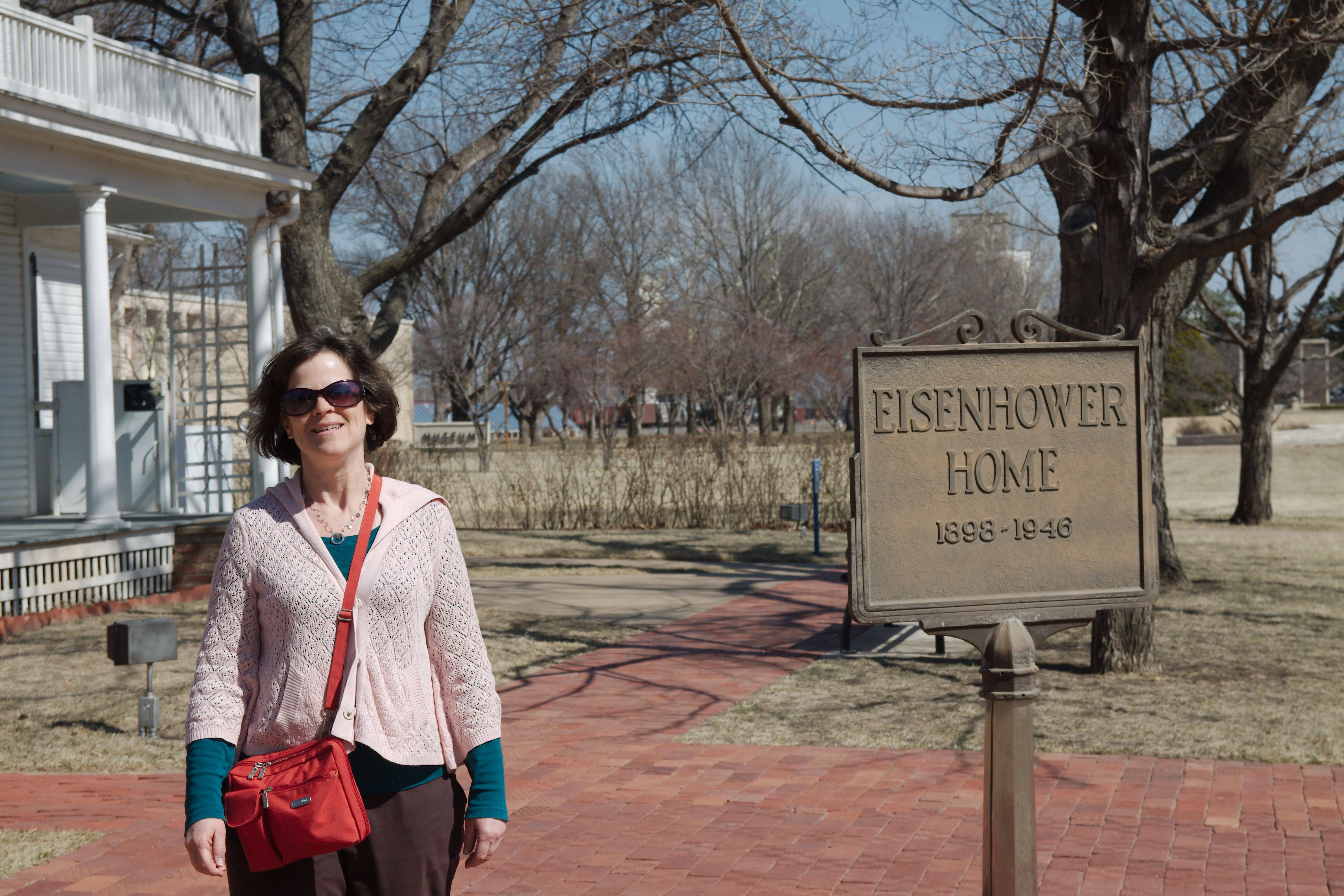
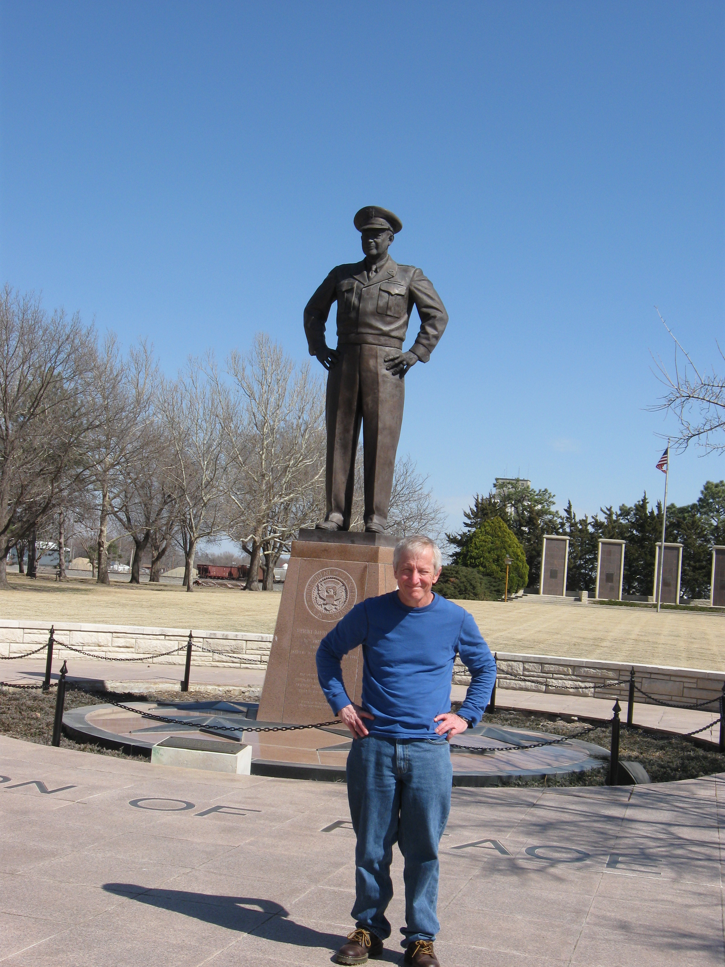
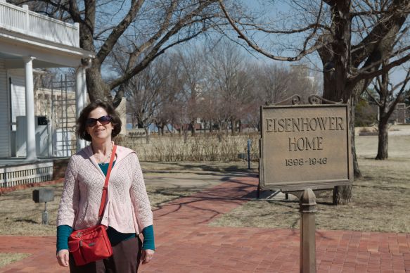
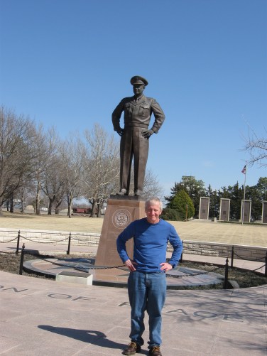
Back on the road, we got on I-70 to start across Kansas. It was in the upper 70s outside, so Amy researched attractions (using the AAA tour book and the Internet via our mobile hotspot). We stopped in Abilene, KS at Dwight Eisenhower’s boyhood home, Presidential library and museum.
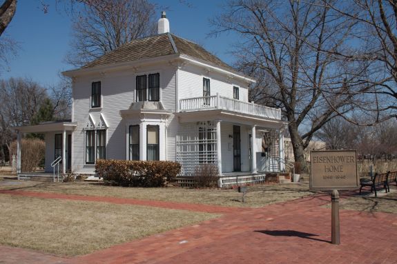
Ike's house.

Ike’s house.

santafe-IMG_8674

IMG_0891

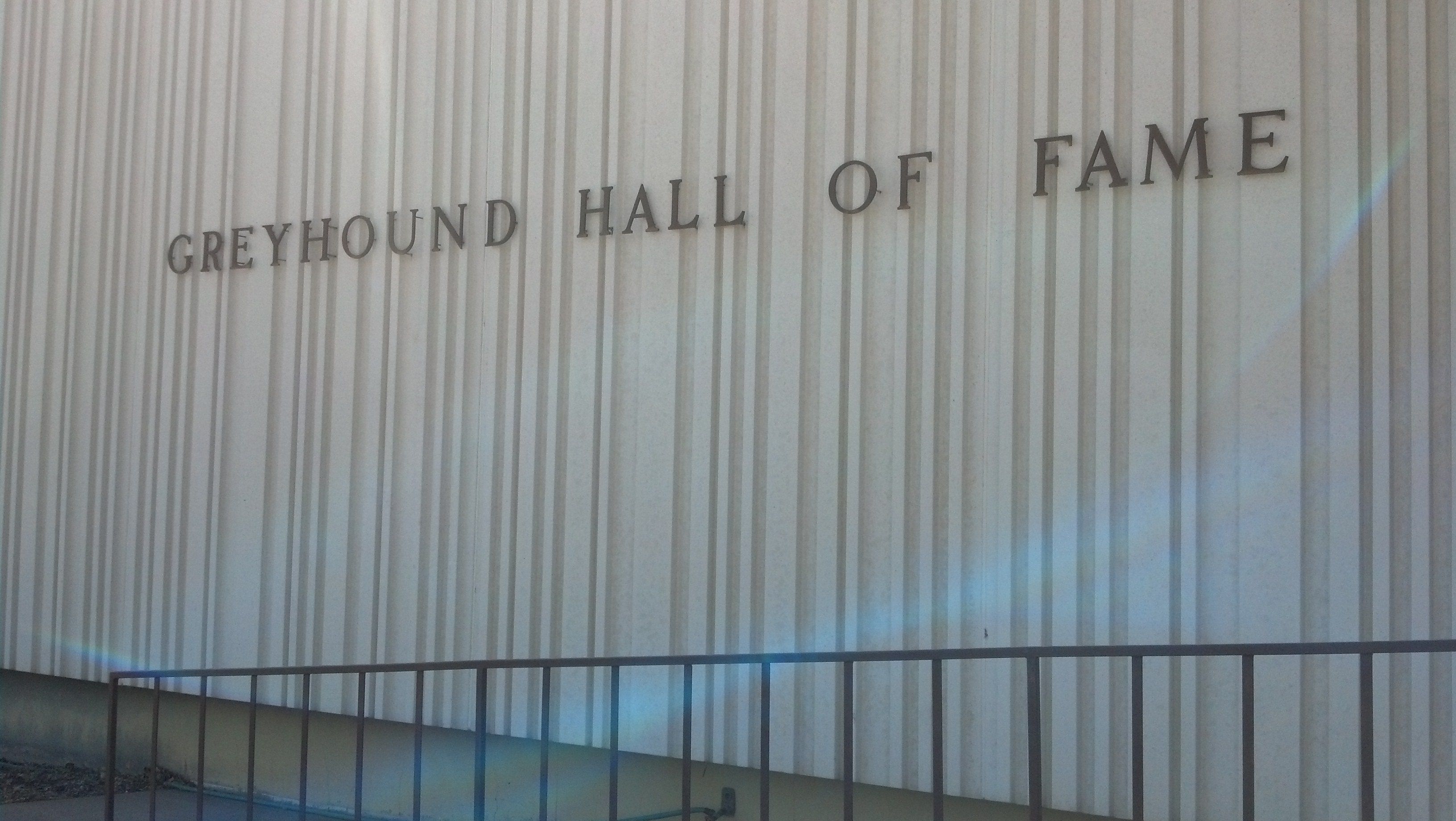
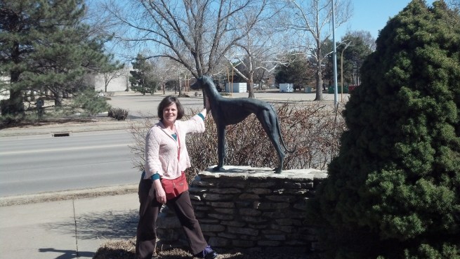
We walked the grounds of the Eisenhower library, then went across the street to the Racing Greyhound Hall of Fame. They had two greyhounds that roam the facility! Also information about greyhound history and racing Hall of Fame.

2014-03-15 15.25.16

2014-03-15 15.24.59

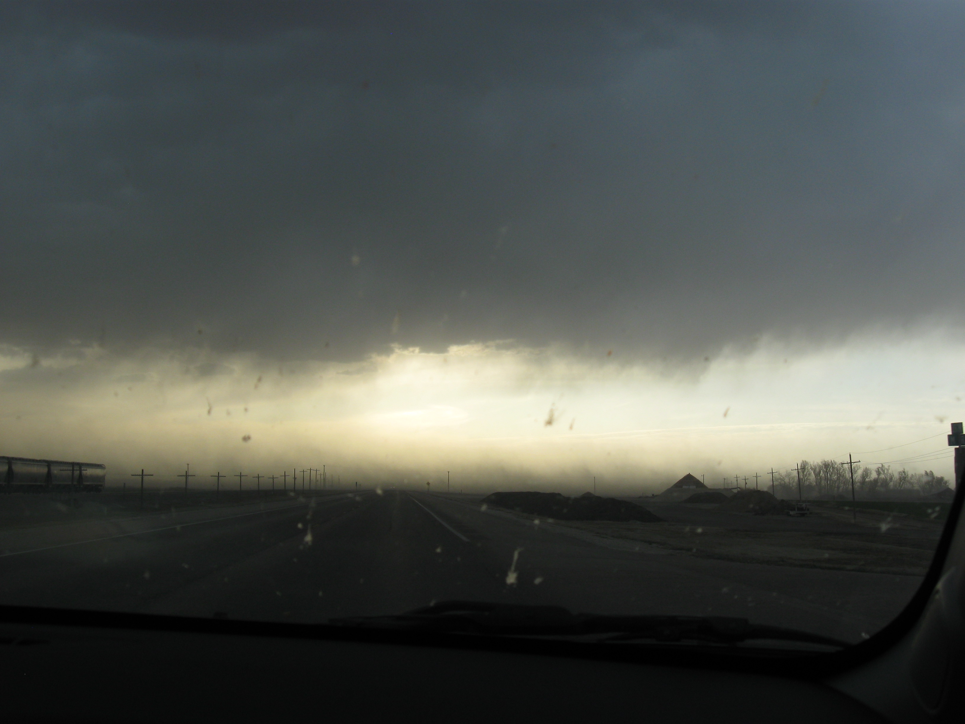
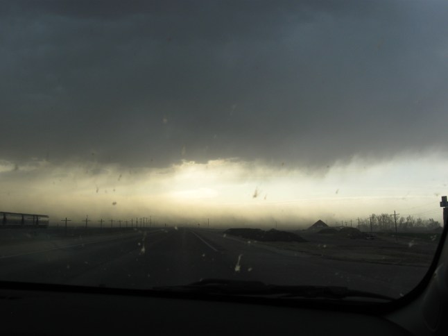
We decided to take back roads from the Greyhound Hall of Fame on our way to Dodge City instead of taking the Interstate. We started on Kansas Hwy 15 south out of Abilene to US Hwy 56 west, which took us all of the way to Dodge City. We stopped in Great Bend at the Chosen Wok for a quick dinner. It cost $4.95 for each large entree and rice. After leaving Great Bend, we ran into some mini dust storms. The wind stirred up dust into the air, making it hard to see, and it hit our car. Yuck! A little scary, too.

IMG_0893

We checked into the Super 8 in Dodge City. Nothing going on there at night – disappointing town. Very windy. We wanted ice cream, and the only place around was the Dairy Queen right next to our hotel, so we walked over.


Sunday March 16, 2014

For breakfast, we skipped the meager offerings at the Super 8 and went to the IHOP and then started the six-hour drive to Santa Fe. We stayed on US Hwy 56, heading SW through the corner of Kansas and then through the Oklahoma panhandle into New Mexico.

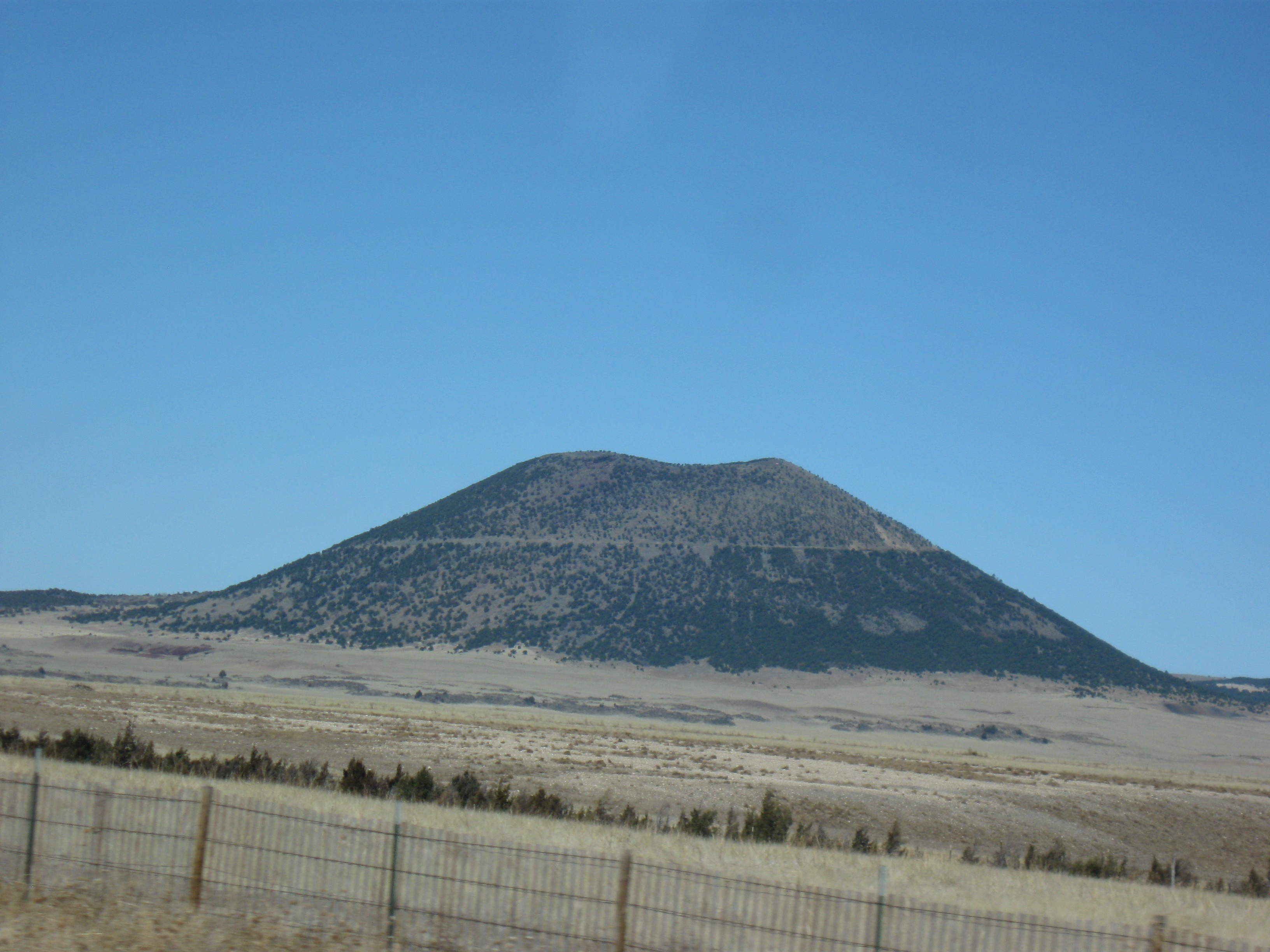
Just across the border in Clatyon, NM, we turned on US Hwys 64/85 toward the Capulin Volcano National Monument.We could see it from quite a ways away.

IMG_0896

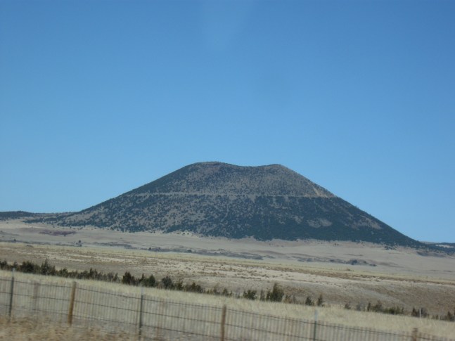
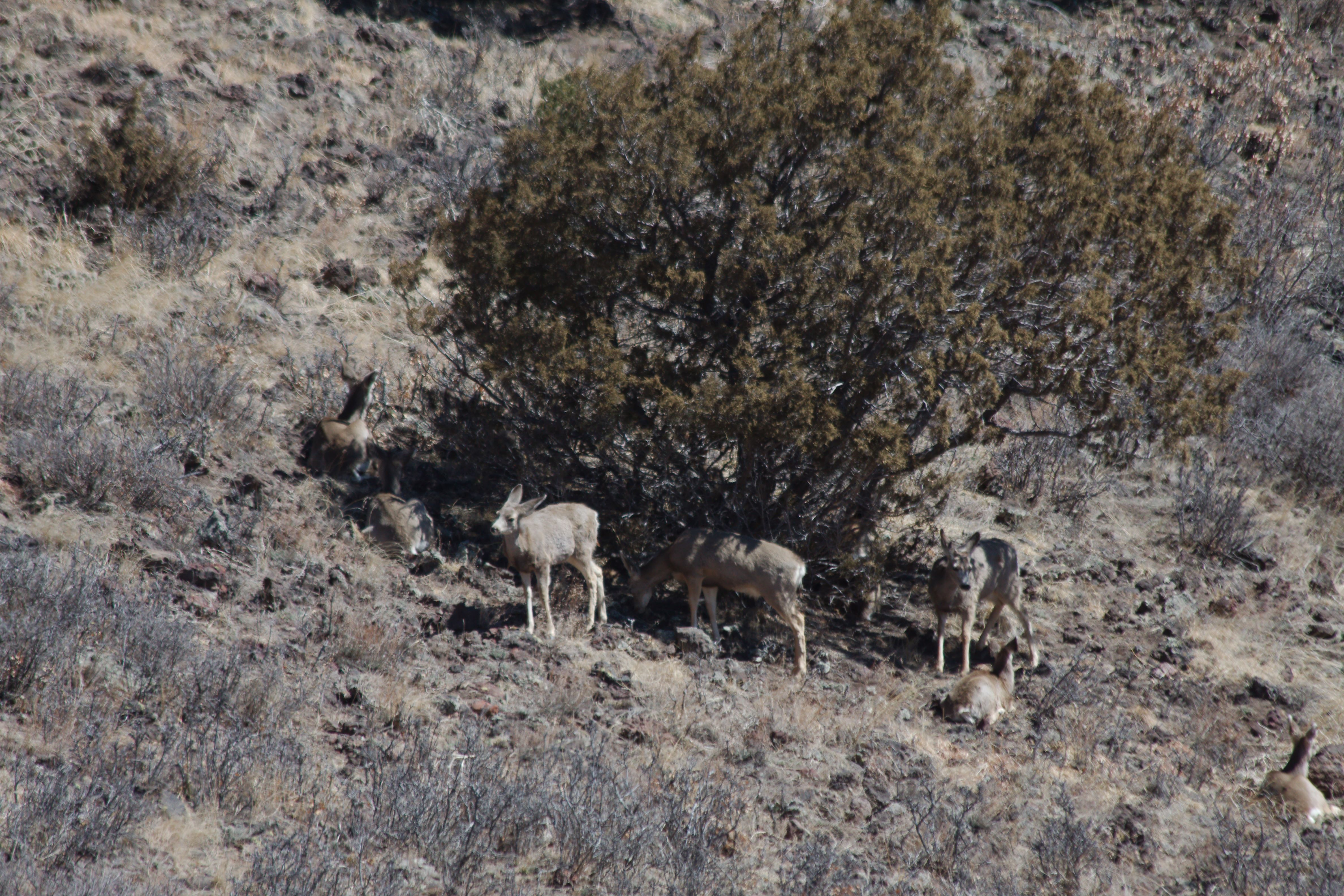
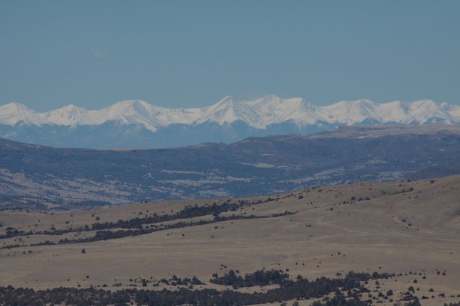
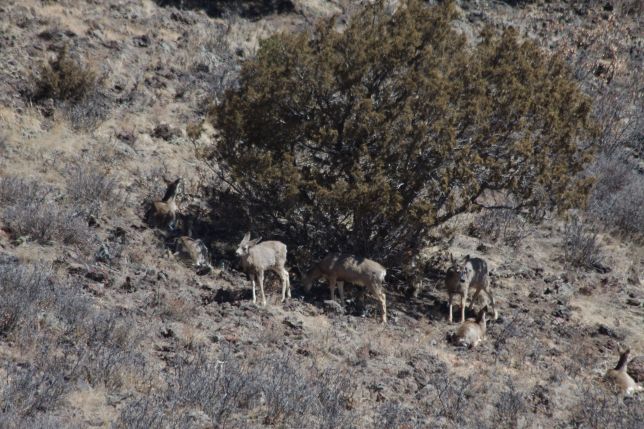
We stopped at the visitor center and bought our pass. It was 40 degrees, but very windy, so it felt much colder. We drove to the top of the cinder volcano and took a walk around the perimeter of the caldera (about a mile). Though it was chilly, the views were beautiful – we could see snow-capped peaks in the west, and mule deer in the caldera.

2014-03-16 11.38.35

santafe-IMG_8687

santafe-IMG_8704

santafe-IMG_8701

santafe-IMG_8708

We left the Monument and drove west, merging onto Interstate 25 south toward Santa Fe. We arrived at about 3PM local time, gaining an hour from the time-zone change. We pulled into the Residence Inn, but when Joel went to check in, they had no reservation on file – Joel had apparently forgotten to hit “Confirm” on the reservation Web page! Luckily, they had availability, so Joel pulled out his tablet, connected to the hotel WiFi and made a new reservation using Marriott points (the front desk couldn’t do it for some reason).

After getting settled in, we drove to downtown Santa Fe and walked around the Plaza- it was a bit cool, but a beautiful evening. We saw shops (some more touristy than others), went into the St. Francis Cathedral Basilica – very picturesque. We then went to dinner at the Rooftop Pizzeria – we had a couple of locally brewed beers (Marble Brewery from Albuquerque) and a pizza with toppings that included roasted garlic cloves. Even had leftovers to take back to the hotel!

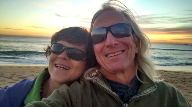
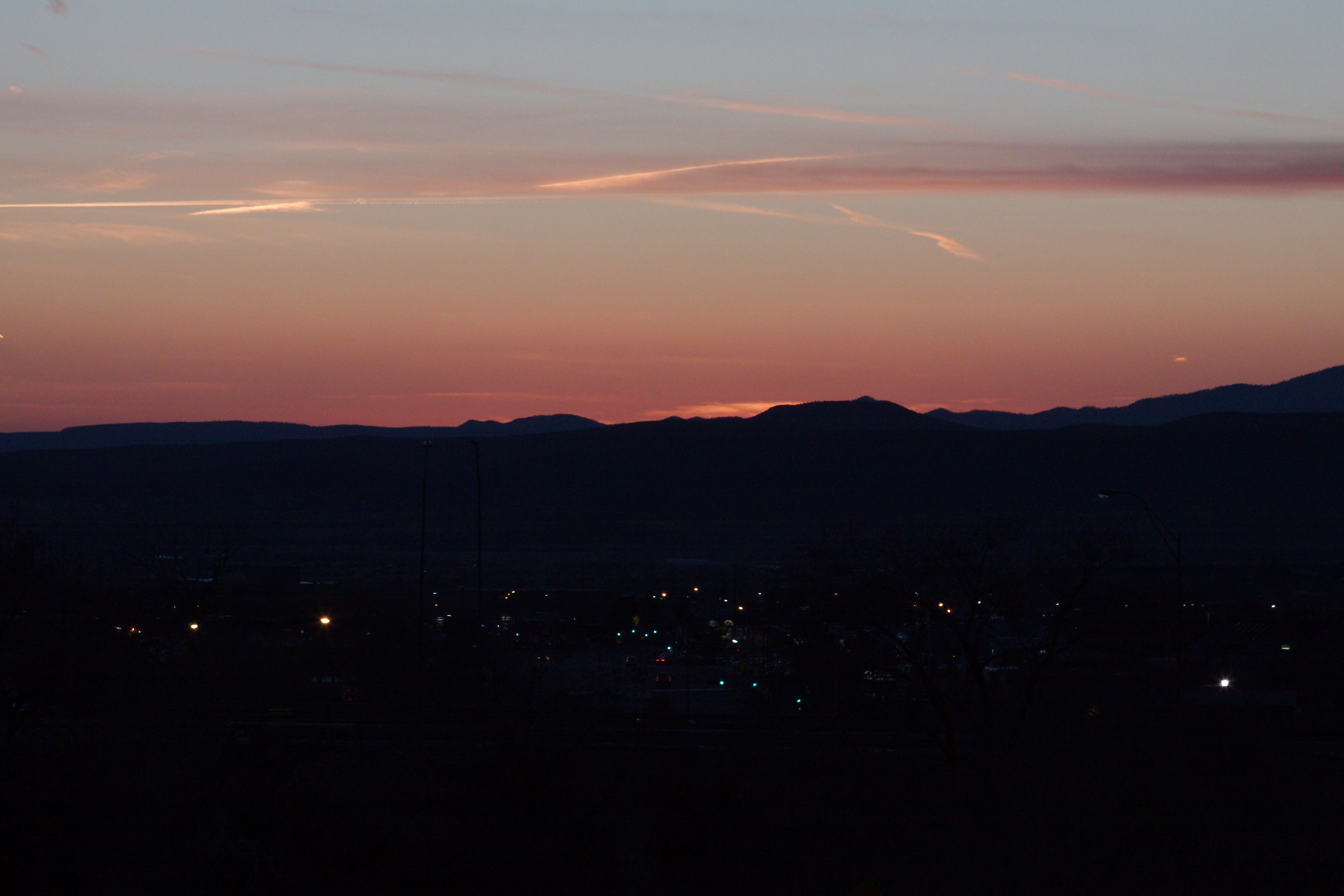
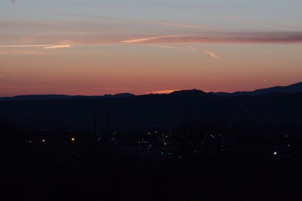
Back at the hotel, we watched an episode of House of Cards on Netflix (we had also watched one in Dodge City). Amy had started having a heavily running nose at dinner, but slept fine and didn’t seem to be sick! At sundown, from our hotel room’s balcony, Joel snapped a picture of the sunset over the mountains with the lights of Sante Fe in the foreground:

santafe-IMG_8725


Monday March 17, 2014

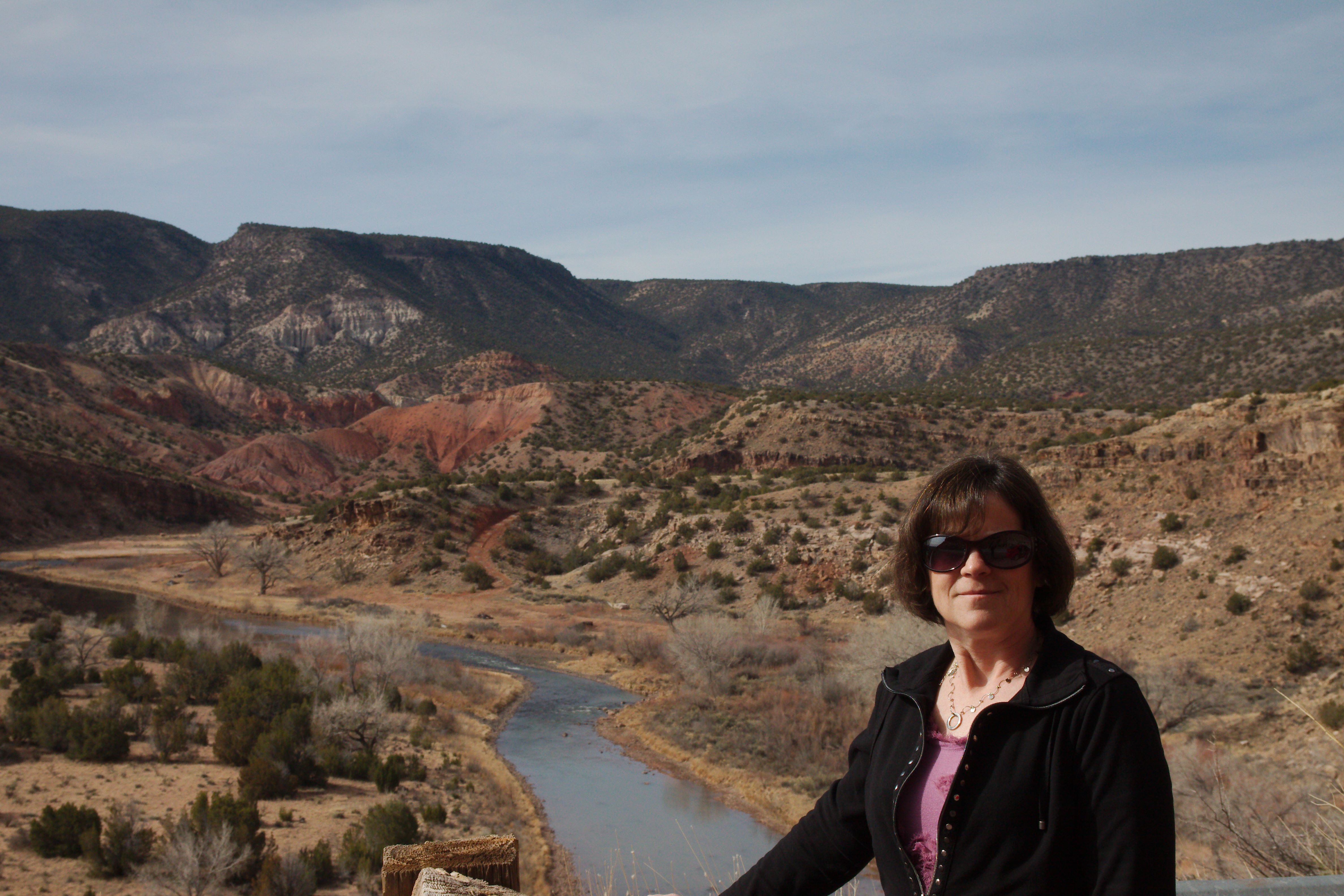
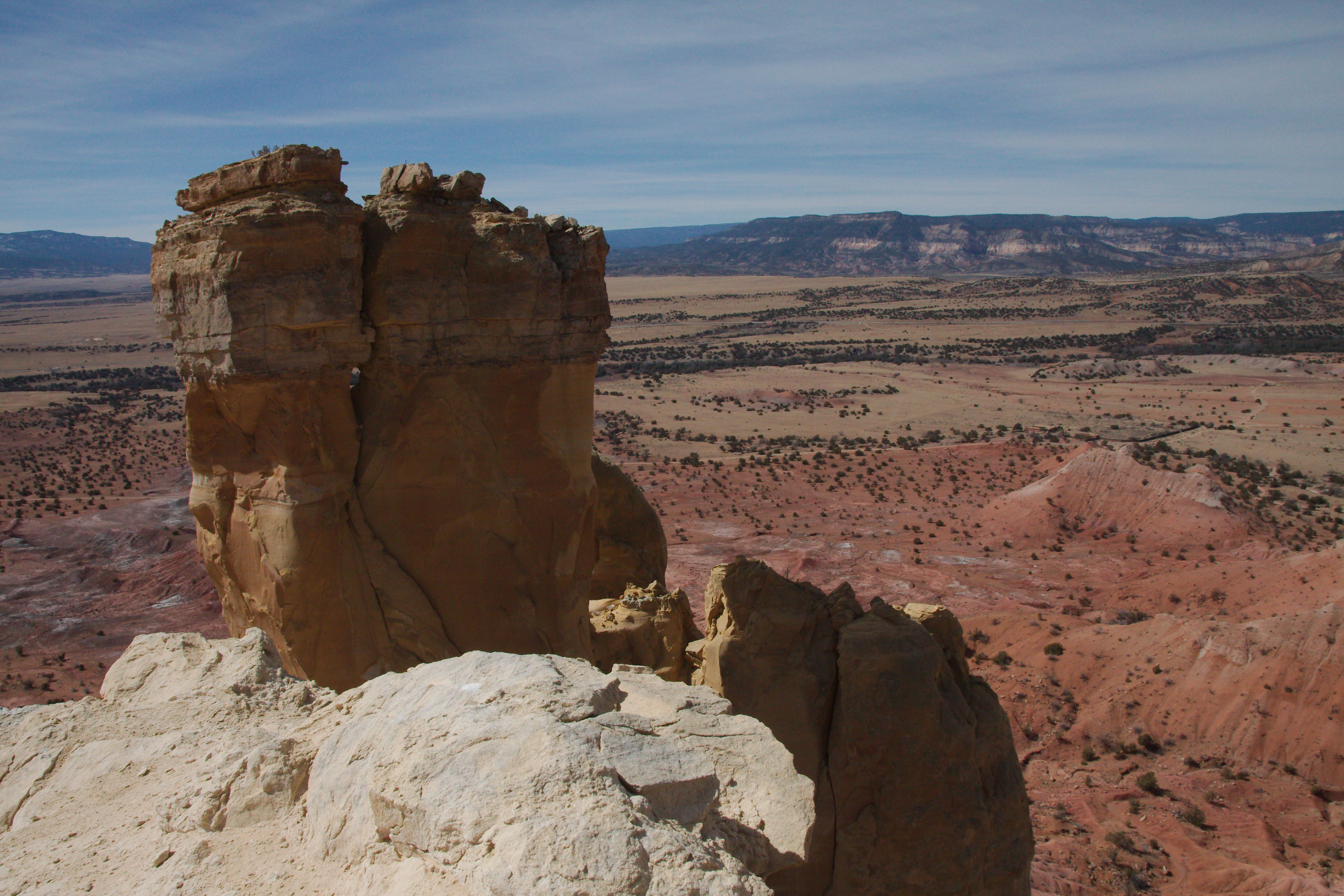
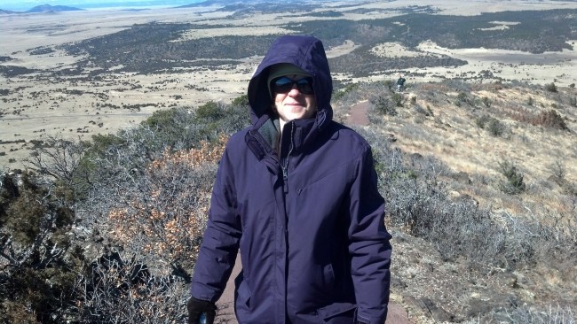
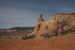
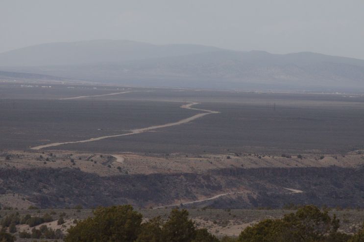
We ate breakfast at the hotel, then stopped at Walgreens for sunglasses for Joel, batteries for Amy’s camera and Cold-EZE and Kleenex for Amy. We headed up north to the Ghost Ranch, which is where Georgia O’Keeffe lived half of the year and Ansel Adams painted scenes. It was a beautiful drive, as you can see from this shot we took from a pullout on the road:

santafe-IMG_8738


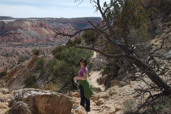
Once at Ghost Rance, we did a three-mile round-trip hike to Chimney Rock – well worth it:

santafe-IMG_8743 santafe-IMG_8759

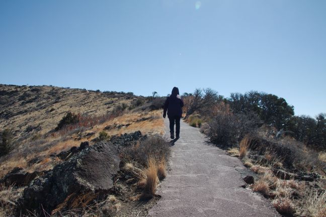
Here’s the view from the top of the hike, looking DOWN on Chimney Rock:

santafe-IMG_8779

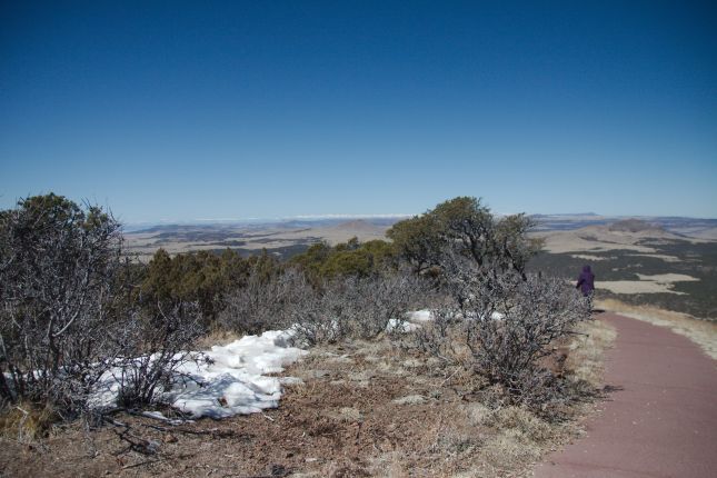
Here we are heading back down:

santafe-IMG_8791

On the way back down, we met a couple who were just starting up. Turns out that they were from Iowa City! The man is a professor at the University of Iowa. We chatted for a moment, then headed into the museum at the Ranch and learned a bit about dinosaurs. The docent enjoyed talking to Joel because Joel had some dinosaur knowledge – all from listening to the Wee Sing Dinosaurs audio tapes with the kids when they were little!

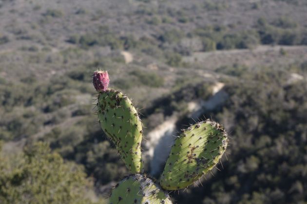
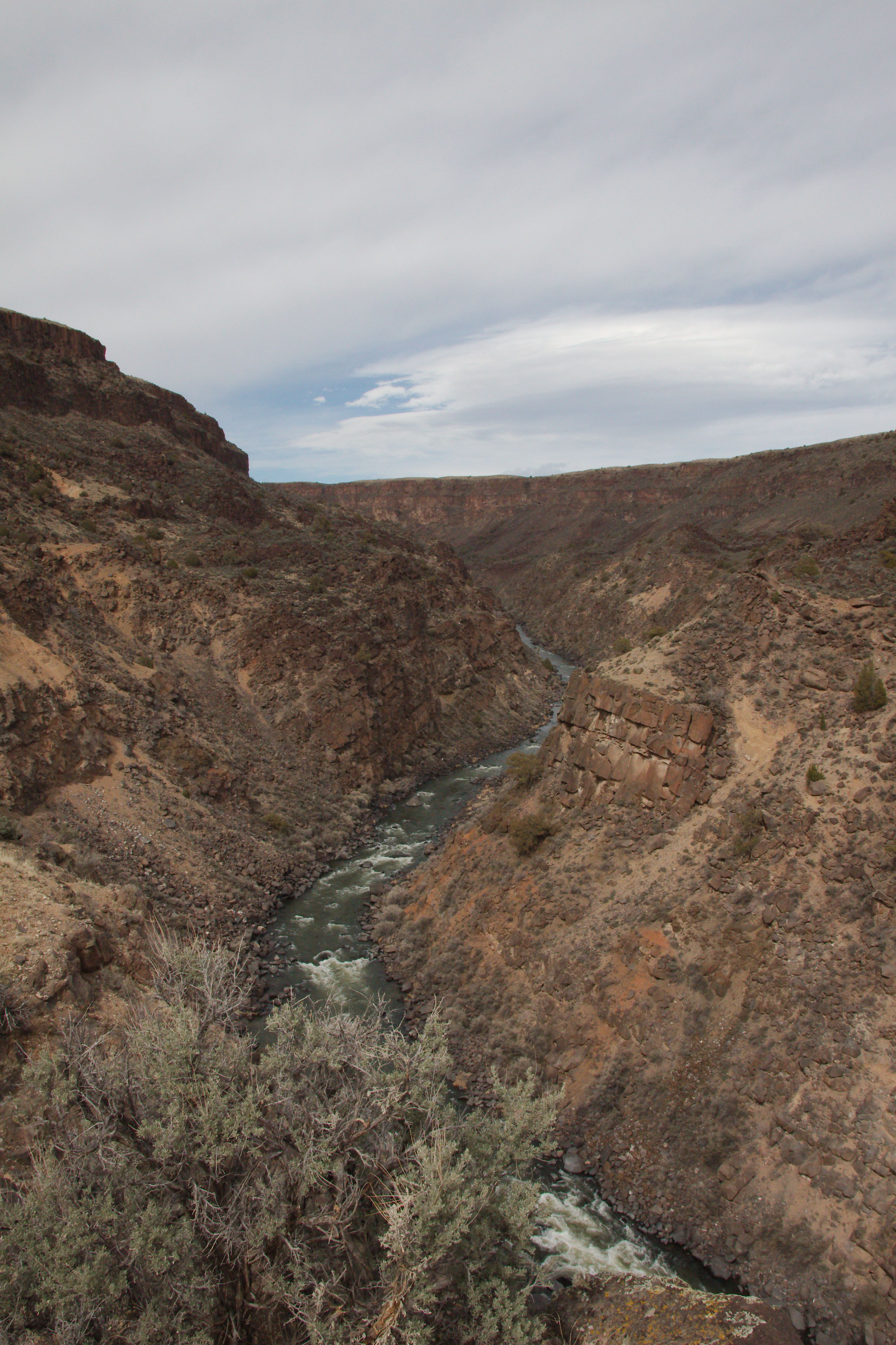
After the museum, we decided to head to Taos. There were no direct routes on major highways, so Amy mapped a course on back roads. All was going well until all of a sudden, the road  turns to gravel and starts a steep, narrow descent into a canyon! It was a scary road, but luckily our rental car was up to the task. At the bottom was the Rio Grande river – there was a small parking lot with a trailhead, so we took a short, two-mile hike paralleling the river amongst black, piled-up rocks and brush and cactus to a great view of a steep gorge and the river:

santafe-IMG_8804

That was the first river we’d seen that had much water in it.

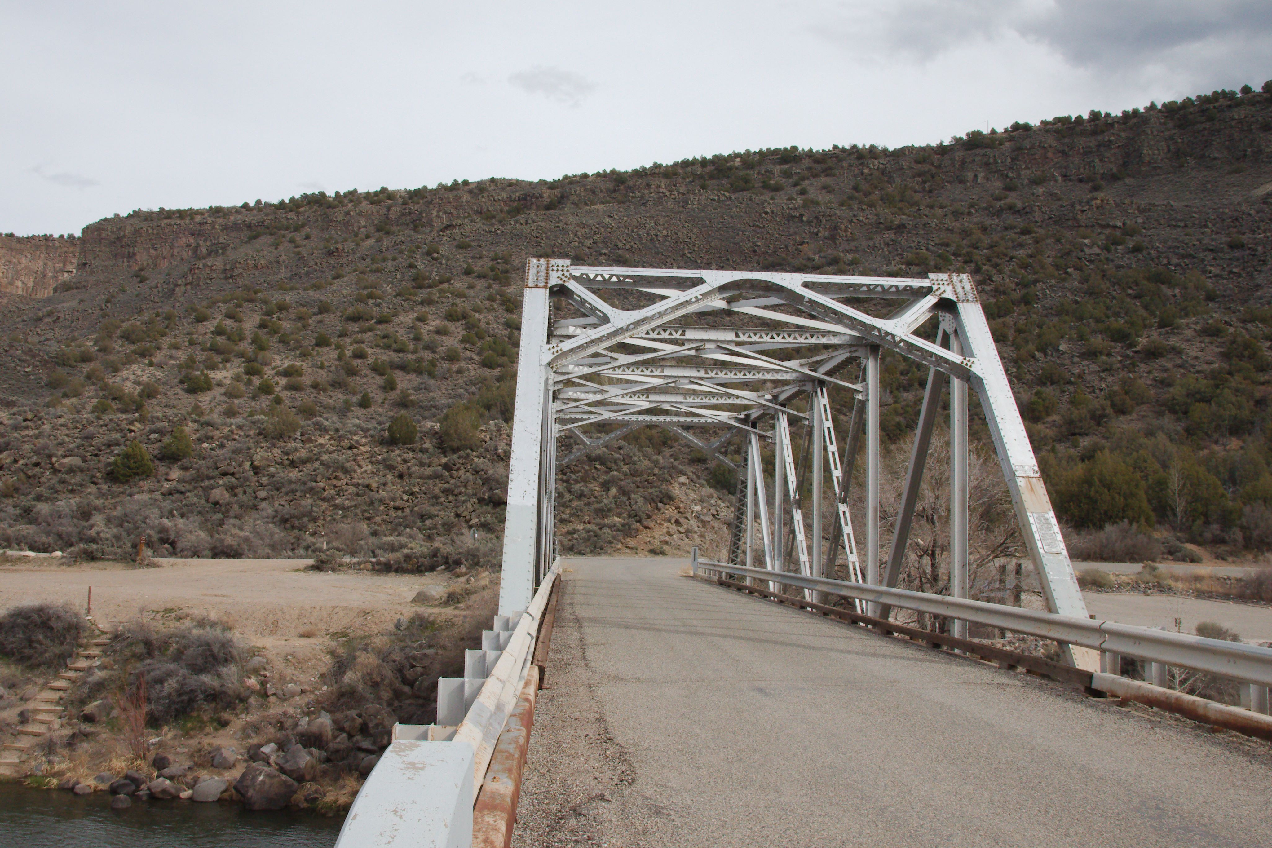
Back in the car, the gravel didn’t last much longer as it turned back to pavement as it crossed the river:

santafe-IMG_8806


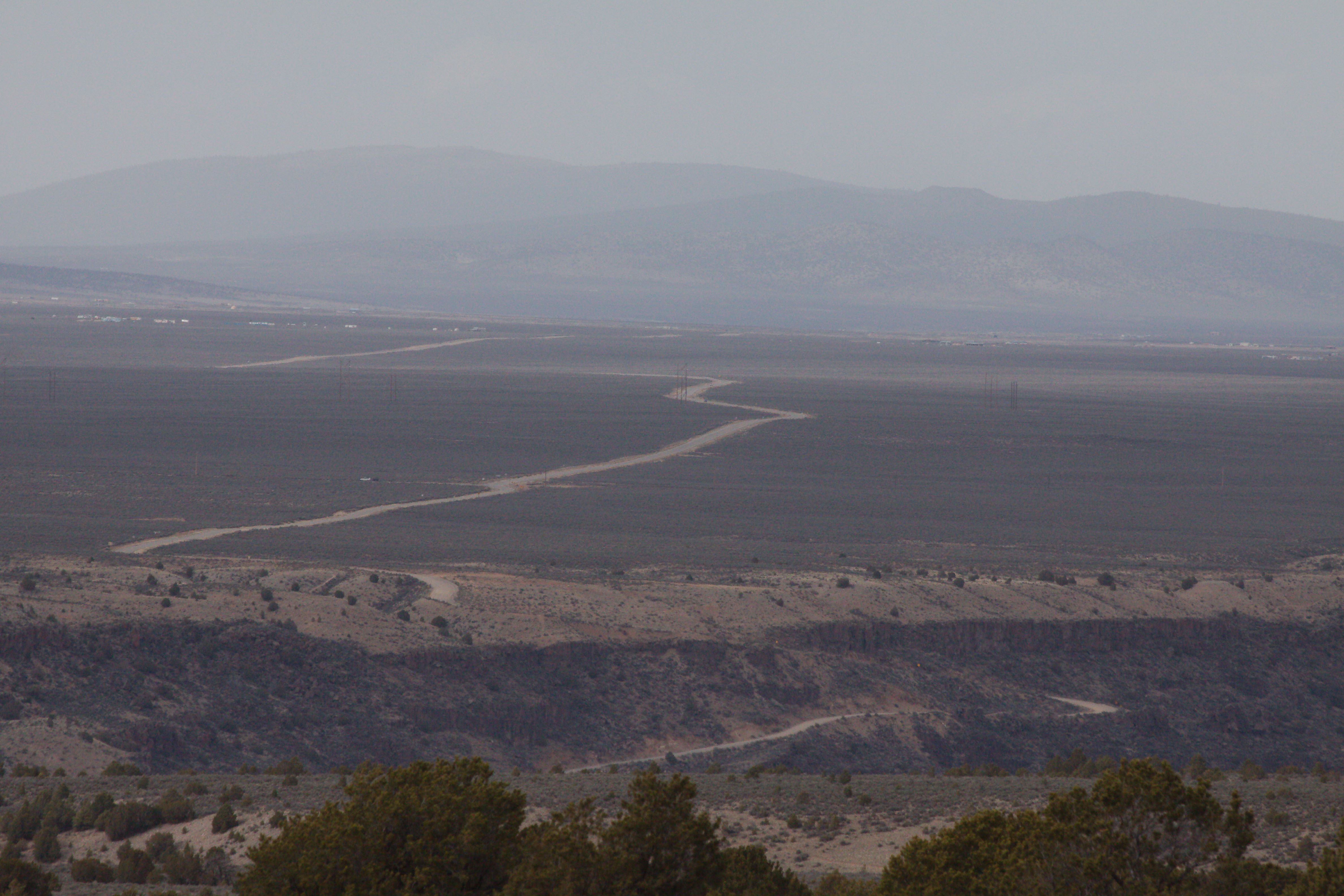
After crossing the bridge, we drive south (away from Taos), parallel to the river until we intersected with Highway 68, which we took back north to Taos. As we drove north, we looked to the west and saw the road on which we had driven from the Ghost Ranch and could see it descending into the Rio Grande canyon:

santafe-IMG_8815

Once in Taos, we walked around a bit, but didn’t have a lot of time because we wanted to drive the High Road back to Sante Fe and wanted it to still be daylight so we could enjoy the scenery. While walking around, the wind kicked up and started a little dust storm. We ate dinner at La Cueva Mexican restaurant. Amy had “Christmas” sauce on her burrito, made of a mixture of green and red chiles. The food was very good – they only had about five indoor tables (too windy and dusty to sit outside!) and we were lucky to get one.

Back on the drive, we took the High Road. Much of the way, the landscape seemed more like Colorado than New Mexico, with lots of evergreen trees and even a few patches of snow. For two sections, the road narrowed to barely one-and-one-half lane wide as we drove through residential areas. We made it back to Highway 285 just as it was getting dark. There was a huge traffic backup as we neared Sante Fe – it was a sobriety checkpoint, probably due to it being St Patrick’s Day. We finally made it back to the hotel after being gone for over 11 hours or so.


Tuesday March 18, 2014

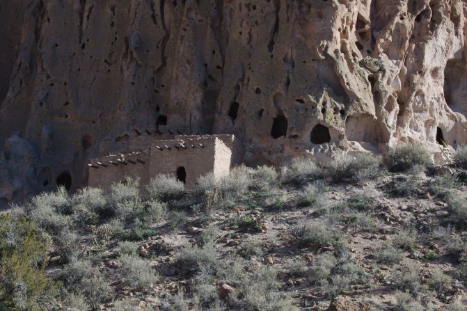
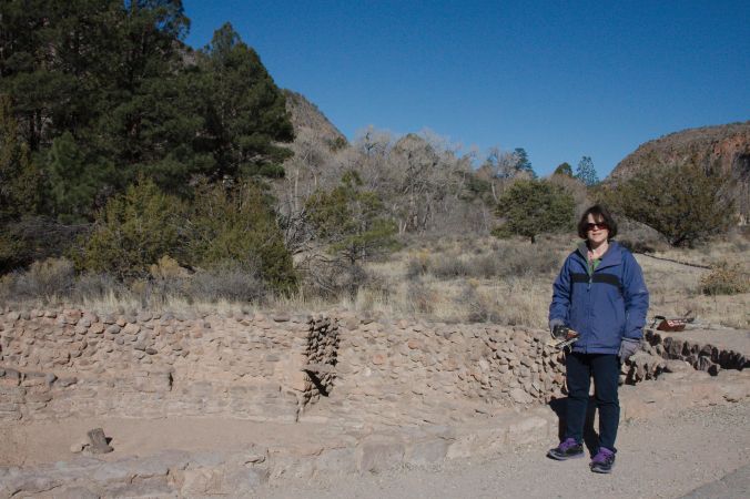
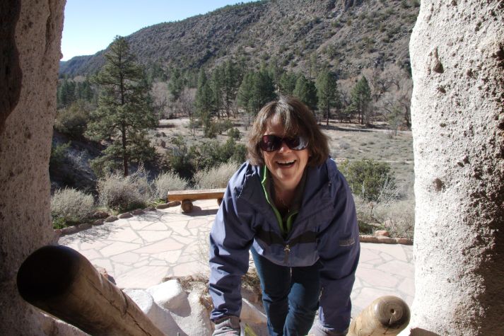
On our way out of town, we bought coffee at a little drive-up stand – for Sam Caster’s sake, we asked about the roaster, and it was “Aroma”, which is a brand roasted locally in Sante Fe. In any case, it was very good. We then stopped at Trader Joe’s to see if they had any Passover food, but it was too early and they had nothing in stock.  Our destination for the day was Bandelier National Monument, which features Pueblo and Anasazi cliff dwellings. From the visitor center, we hiked past the ruins and reconstructed dwellings.


santafe-IMG_8828


santafe-IMG_8822

We saw petroglyphs, which are images that the ancient inhabitants created by carving away from a rock face. The best example was this parrot:

santafe-IMG_8850

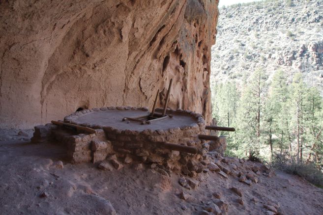
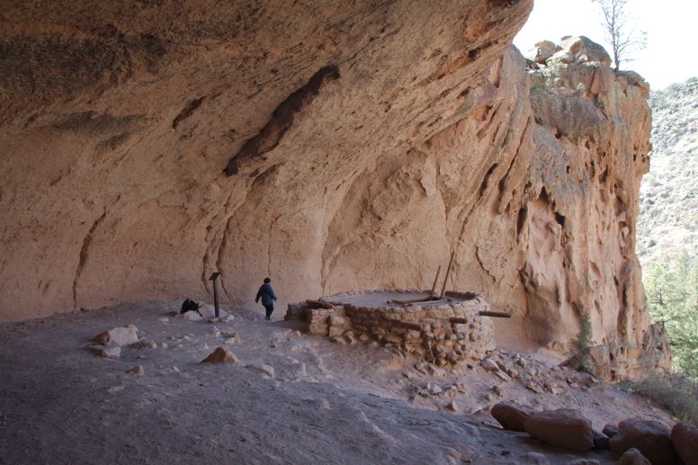
We were able to climb into some of the reconstructed cliff dwellings, using wood-pole ladders.

santafe-IMG_8835

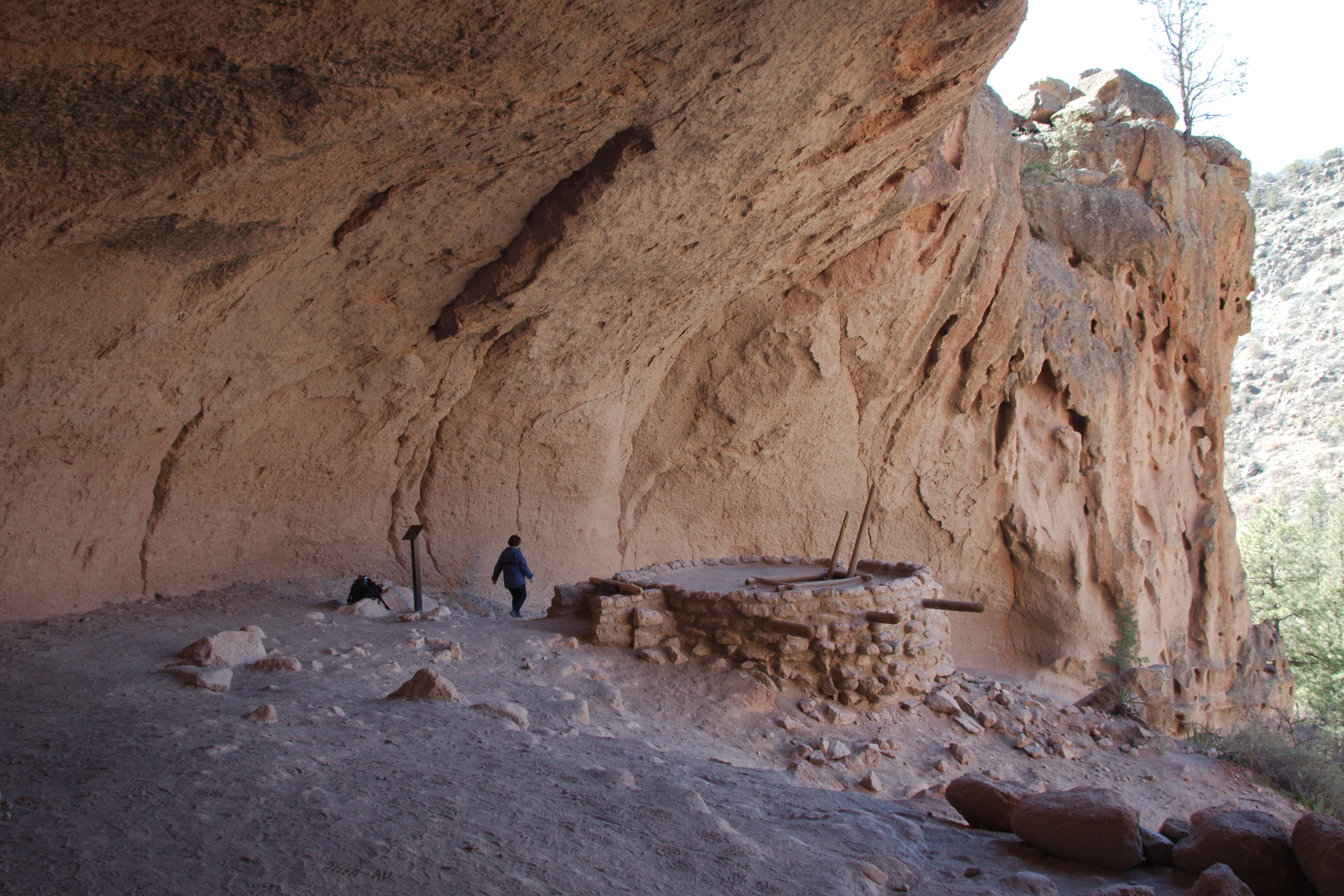
At the turnaround point of our hike was the Alcove House, where we climbed 140 vertical feet, using a total of four ladders. In the Alcove House, there was a kiva that the rangers discovered that still had intact bedding, etc. after 450 years!
santafe-IMG_8853

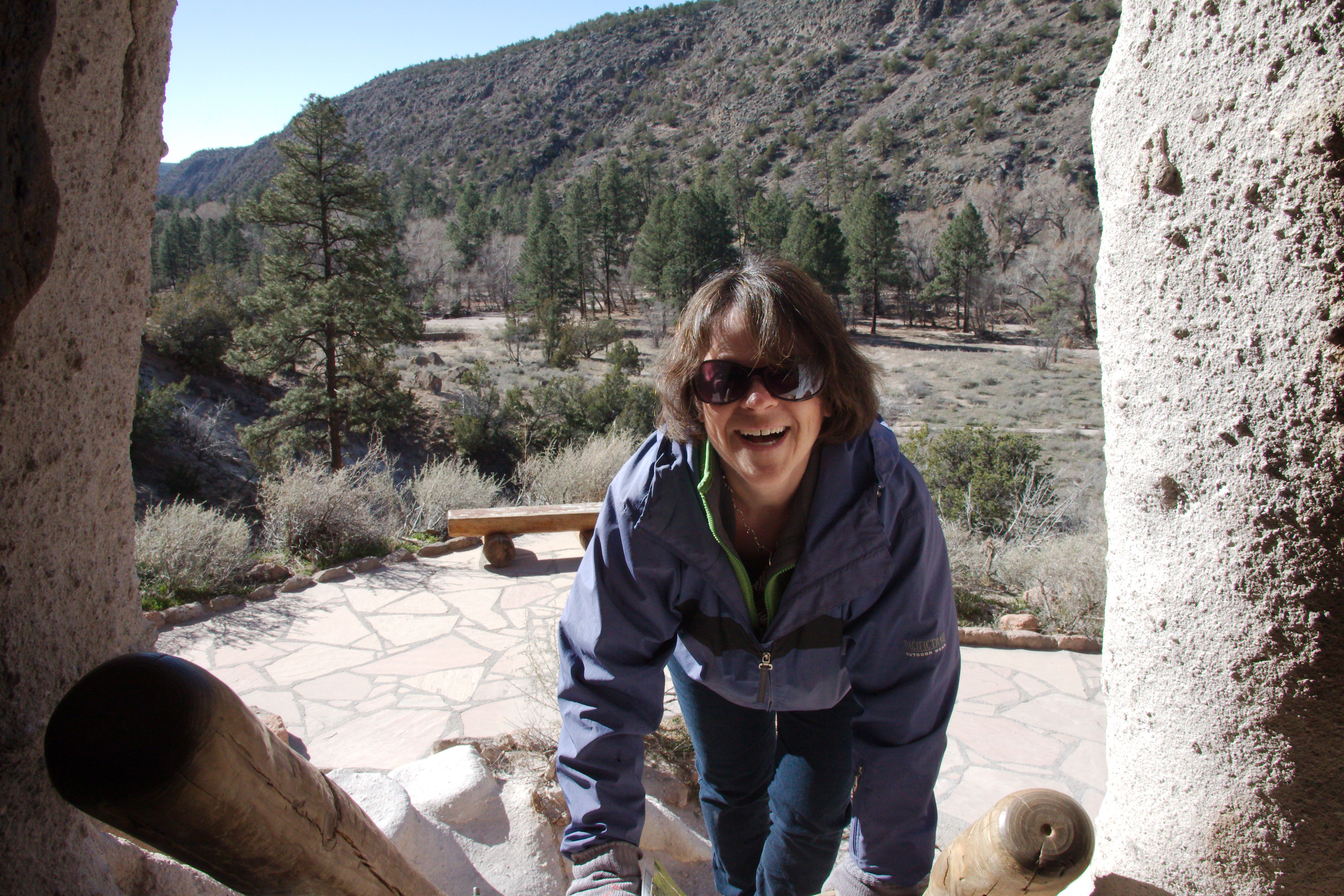
The Alcove House was quite large – here’s  partial picture of it with Amy by the kiva to show scale:


santafe-IMG_8854

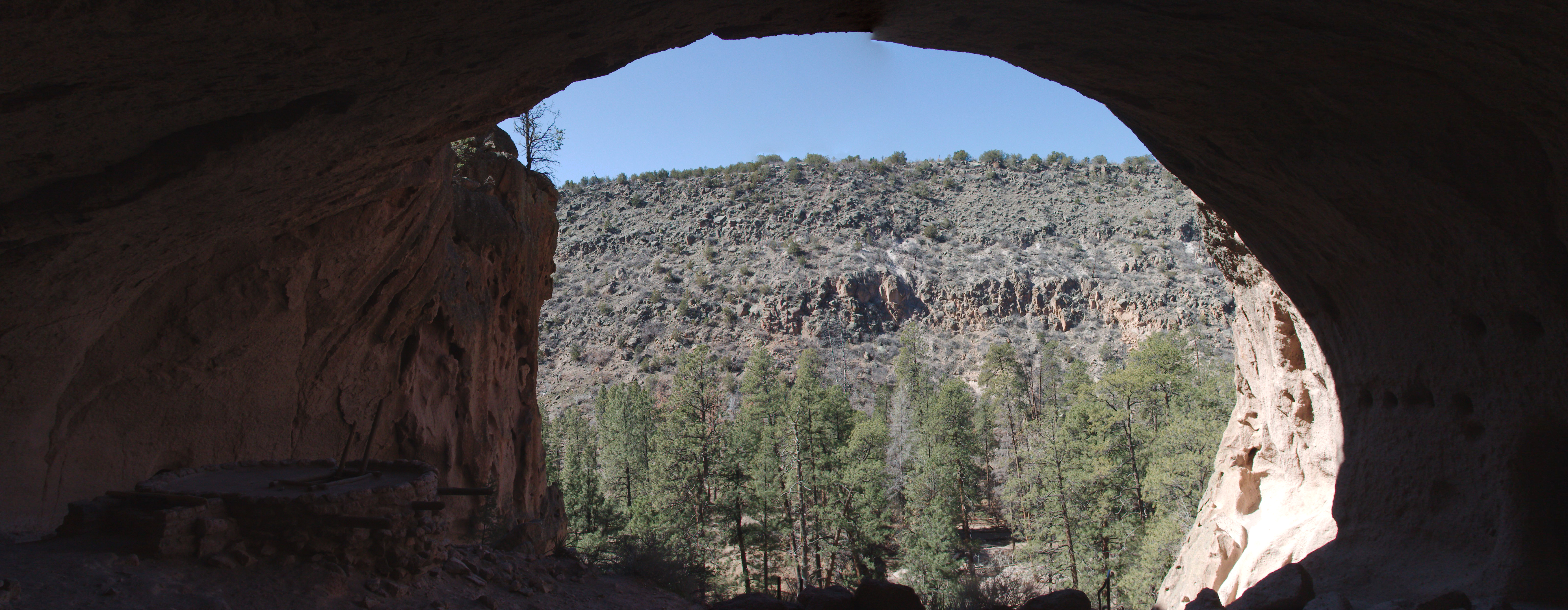
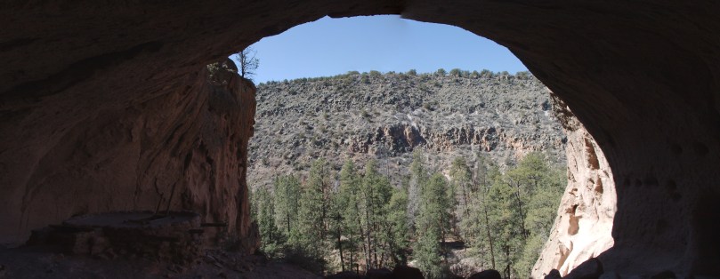
And here’s a panorama that Joel stitched together from three separate pictures looking from the back of the Alcove House to entrance:


alcove-house-panorma

After hiking back from the Alcove House to the visitor center (about 2.5 mile round-trip), we sat at a picnic bench and ate leftover pizza. Then it was time to start the long drive back to Iowa.

To get back to Interstate 25, we had to backtrack to Sante Fe, so we stopped at an Albertson’s grocery store to see if THEY had had any Passover items (since Trader Joe’s didn’t). They did have Yehuda matzah, whole-wheat matzah and matzah-ball soup mix, but nothing other than the basics. We hopped on I-25 to start our trip home.

As we headed north toward Colorado, before we reached the town of Springer, NM, we could see low, dark “clouds” up ahead. Amy looked on the Internet and saw that there was a wide-spread wind advisory with blowing dust. The beautiful blue sky disappeared and was replaced with thick dust that blocked the sun and severely reduced visibility.  We missed the wonderful views of mountains as we left New Mexico and headed into Colorado.

After crossing the border, we took a diagonal route, Highway 350 northeast toward Interstate 70, heading toward the town of La Junta. This was the most desolate road of the whole trip. There was literally no civilization for that whole segment – barely any oncoming traffic and very spotty cellphone service. Our plan was to stop in La Junta or Lamar for dinner and gas. Though cellphone service was intermittent (and Internet non-existent), we were able to text Gail back in Cedar Rapids and ask her to Google restaurants. She found the Bamboo Panda in La Junte, and it was a good choice. As we stopped to park, the air quality had improved, but it was still very windy and there was still a lot of dust.

After leaving the restaurant, we headed east toward Garden City, Kansas, which was to be our stop for the night. About 20 miles from Garden City, we pulled over to look at the night sky. The sky was now clear of dust, and so dark – the stars were so bright! We hid behind the car to block the cold wind as we looked up in wonder – it was like we were in a planetarium, with the Milky Way showing all of its glory. We then finished the drive into Garden City and checked into our hotel.


Wednesday March 19, 2014

We got an early start onto the road and faced our big decision of the day: whether to drive through Omaha and see Jack and Bette or to take the direct route home through Kansas City, perhaps stopping yet again to look for Passover food. Amy called around and discovered that the Hen House grocery store chain in KC had a reputation for stocking the most Passover goods, so she called them to see if they had kosher liver so we could have chopped liver at the seder. They did not. But nonetheless, we decided to still go through KC and try again to get into Oklahoma Joe’s for BBQ.

We drove on Highway 56 east across Kansas, but as we went, we changed our minds and decided to go to Omaha after all (after calling Jack and Bette to let them know!). So we cut north on Highway 77. And we did get some BBQ at Cox Brothers BBQ in Junction City, Kansas. It was pretty good, but was no replacement for Okie Joe’s! Junction City is the home of Fort Riley, which itself is the home of the US Army’s 1st Infantry Division, aka the Big Red One so we treated ourselves to a little online World War II history lesson.

Still heading north, we went through Marysville, Kansas, which bills itself as “The Home of the Black Wild Squirrels” (we didn’t see any). Near Marysville, we saw road signs for the Sante Fe Trail (most of our trip was near it), the Oregon Trail and the Pony Express route.

After crossing the Nebraska border and driving the outskirts of Lincoln, we headed on Interstate 80 into Omaha, then stopped for about an hour to see Jack and Bette. Then it was time for the final leg home. Since we had no food in the house, we made one last stop – as we drove by Newton, Iowa, we saw a sign for Montana Mike’s steakhouse. Since we’d seen one of them in nearly every town in Kansas and New Mexico, we decided to stop for dinner. It was OK. We then got back in the car and finished the drive, arriving home at about 9PM. Whew!

THE END

Winter Roadtrip 2013

Written by Amy, pictures by Joel

Thursday, February 14

We left Cedar Rapids at about 1PM, heading to Indianapolis. Joel suggested trying to find a supper club just over the Indiana border for dinner. We realized that it was Valentine’s Day, but thought we’d get there by 5:30, which was maybe early for the dinner crowd, but then we realized the time zone changed, and it would be 6:30! Luckily, we did get into the The Beef House in Covington. They are known for their rolls, which our waitress took a while to bring us! We spent the night at a Holiday Inn Express in south Indianapolis.

Friday, February 15

We took I74 around Cincinnati  and then I75 south past Lexington, KY, then stopped in Corbin, KY. We had a little snow and rain most of the way. Corbin is the birthplace of Colonel Sanders famous chicken recipe. They have a “museum” where the cafe that was that first served his chicken. (It is now an official KFC, as we found out when we got there.) It would’ve been better if it was still a cafe!

Had a little lunch there then decided to go to Cumberland Falls, which is southwest of Corbin. Still rainy, but mostly just intermittent drizzle. We first stopped at an overlook of the hilly forest:

Image

Then we found the waterfall itself. There was a nice pathway to get to it – it stopped raining for our little walk! Not a tall waterfall, but very wide and powerful:

winter-roadtrip-2013-IMG_7675

The falls are called “The Niagara Falls of the South”. On rare occasions, it will produce a moonbean rainbow – moonlight plus mist from the falls. The rainbow is best seen in winter during a full moon on a clear night. According to the literature, Cumberland Falls is only one of the two falls in the world to produce moon rainbows!

We headed back to the outskirts of Corbin for gas (the most redneck gas station and people we’ve ever seen), then went on highway 25E to Middlesboro and Cumberland Gap National Historic Park. It continued to rain and drizzle on the drive, but as soon as we went into the visitor’s center, it stopped! We took a short hike to the Saddle of the Cumberland Gap:

winter-roadtrip-2013-IMG_7692

winter-roadtrip-2013-IMG_7694

Then we hiked up Tri-State Peak, where three states meet up (Kentucky, Tennessee and Virginia):

winter-roadtrip-2013-IMG_7699

winter-roadtrip-2013-IMG_7702_1

winter-roadtrip-2013-IMG_7703

winter-roadtrip-2013-IMG_7704

winter-roadtrip-2013-IMG_7705

winter-roadtrip-2013-IMG_7706

Back in the car, we drove through the Cumberland Gap tunnel into Tennessee and headed to our hotel in Morristown. We had dinner at the Akita Express Japanese Grill, which was a fast, casual Japanese eatery. The cashier and wait staff had a definite southern twang. The entrees came with sweet carrots and “shrimp sauce”, which seemed to be mostly mayonnaise and chili powder.

Saturday, February 16

Headed toward Asheville, NC. It snowed as we drove through the mountains, but luckily it didn’t stick to the road or get slick. We decided not to do the Biltmore tour. We drove around Asheville, but it was rain/snowing and cold, so we didn’t do much there. We left town and tried to drive on the Blue Ridge Parkway, but it was closed.

Instead, we decided to take back roads instead of Interstate 26 – most of the way on US Highway 176. It was very scenic and more relaxing than rushing through on the Interstate. Near the town of Saluda, we saw a sign that said “Pearson’s Falls – Open”, so we took the mile-long crossroad to check it out. Operated by the Tryon Garden Club, Pearson’s Falls is a natural area with trails, gardens and of course, the falls themselves. We took the winding path to get to the falls:

winter-roadtrip-2013-IMG_7726

The falls themselves were very nice:

winter-roadtrip-2013-IMG_7709

winter-roadtrip-2013-IMG_7713

winter-roadtrip-2013-IMG_7719

After leaving the waterfall, we continued on Route 176 into Spartanburg, SC. We found a Cuban restaurant, “A Caribbean Sweetness” on tripadvisor.com, and it was very good. Then we drove through Columbia, SC and we were not impressed with the town. Seemed grungy.

Then we drove down to Charleston, SC, mostly on back roads. Joel enjoyed stopping to take pictures of rundown houses:

winter-roadtrip-2013-IMG_7728

winter-roadtrip-2013-IMG_7730

winter-roadtrip-2013-IMG_7732

In Charleston, we splurged on two nights at the downtown Marriott Courtyard using reward points. The area was very crowded due to a three-day Southeast Wildlife Expo partially taking place in Marion Square. The square was named for General Frances Marion, the Swamp Fox – who is also the namesake of Marion, IA. The square had a nice statue of the Swamp Fox on a tall pillar:

winter-roadtrip-2013-IMG_7776

For dinner, we ordered a pizza from Mellow Mushroom that we walked to pick up then ate in the hotel room. Then we watched an episode of the Netflix series, House of Cards on Joel’s tablet.

Sunday, February 17

We found a bagel place, The Bagel Shop, for breakfast. There, we met a nice older couple that was in town for the Wildlife Expo. They had three-day passes, but were going home a day early and gave us their passes! It was cold and windy outside, but the sun was shining, so we first quickly visited the Expo, then walked down to the Kahal Kadosh Beth Elohim synagogue, the oldest continuously operating synagogue in the US. A nice guard let us in and we went through their museum, then took a brief guided tour:

winter-roadtrip-2013-IMG_7738

winter-roadtrip-2013-IMG_7739_1

winter-roadtrip-2013-IMG_7740_1

After leaving the synagogue, we walked around scenic Charleston:

winter-roadtrip-2013-IMG_7748

winter-roadtrip-2013-IMG_7759

winter-roadtrip-2013-IMG_7764

winter-roadtrip-2013-IMG_7766

winter-roadtrip-2013-IMG_7769

Then we brought lunch back to the hotel to eat while watching Iowa play Minnesota in basketball. Luckily the Hawks won!

Later that day, we walked around Marion Square to see the end of the Wildlife Expo, then met Rabbi Aaron Sherman and son Eli at a Starbuck’s (Stephanie wasn’t feeling well and didn’t join us). We found out that Eli likes birds.

Later, we went to CO, a “hip” Vietnamese restaurant, for dinner. We had pho to warm us up from the cold, windy day (they also served Bell’s Two Hearted Ale in bottles!).

Monday, February 18

Presidents Day and Joel’s birthday. We left Charleston and drove up to Sunset Beach, NC to see our old friends Tom Gaven and Maria Knapik. We had lunch at their house, and then they took us on a tour of the town and a walk on the beach – it was the best day weather-wise, sunny with temperatures in the upper 40s.

winter-roadtrip-2013-IMG_7780

winter-roadtrip-2013-IMG_7782

winter-roadtrip-2013-IMG_7788

winter-roadtrip-2013-IMG_7801

We celebrated Joel’s birthday with Tom and Maria at Flying Fish Public Market and Grill in North Myrtle Beach. We had wanted fresh seafood, but they really didn’t have any local catch, so that was a bit disappointing (plus the seafood chili had WAY too much chili powder!). We spent the night at a Holiday Inn Express in Little River, SC.

Tuesday, February 19

Started driving on back roads (mostly state road 9) up to Charlotte, NC to visit Mark, Kandis and Christian. It rained much of the way, but before it started, saw an owl and an old, abandoned airport:

winter-roadtrip-2013-IMG_7808

winter-roadtrip-2013-IMG_7809_1

The rain stopped as we neared Charlotte. Once there, we went to Glieberman’s Kosher Mart and Deli looking for Passover food. They didn’t have it out yet, but we did share a pastrami sandwich. We then stopped at Trader Joe’s, but they also had no Passover goods, but we did buy some Dogfish Head brewery products not available in Iowa (60-Minute and 90-Minute IPAs).

We checked in at the Fairfield Inn in north Charlotte, then waited to hear from Kandis. It ended up that Christian had to work and Mark was stuck in meetings at work, so we went with Kandis to Bobbee O’s BBQ for dinner. Then Amy and Kandis drove to Target to see Christian at work while Joel crashed in the hotel.

During the past couple of days, we had been monitoring a snow storm heading toward the Midwest. Our plan had been to take back roads up through West Virginia and spend the night in Huntington and then drive home on Thursday, but due to the storm, we decided to drive the whole way back on Wednesday.

Wednesday, February 20

We started the drive at 6:30AM and took I77 north to Charleston, WV and then I64 to Louisville, KY. Then we took I65 to Indianapolis and I74/I80 back home. Stopped at Zaxby’s in Frankfort, KY for a quick lunch.

We got home around 8PM Central time and beat the storm easily. The next morning, we picked up Bruce from the Shepard’s and started getting back to the old routine.